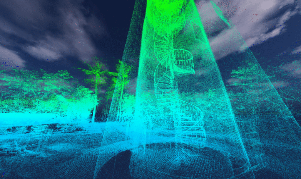
RealitySync transforms how professionals visualize and document physical spaces. Using high-precision 3D scanning, we create photorealistic digital twins that support renovations, facility management, space planning, and safety preparedness.
With RealitySync, you gain unparalleled insight into your environment, allowing you to measure, analyze, and optimize every detail remotely with precision.
Accurate as-builts are the foundation of efficient planning, risk mitigation, and operational success.
Our technology helps professionals across various industries to:
Enhance safety and emergency preparedness with precise models for evacuation routes, crowd flow analysis, and security planning.
Eliminate costly miscalculations by ensuring every measurement is captured with pinpoint accuracy.
Optimize space utilization
by analyzing layouts for efficiency, accessibility, and maximum functionality.
Reduce downtime and disruptions during renovations or reconfigurations by planning with a true-to-life, interactive model.
Showcase properties and projects remotely with high-resolution virtual walkthroughs, improving client engagement and decision-making.
Streamline remote collaboration
with detailed, shareable 3D models that improve communication and reduce errors.
How RealitySync Supports Your Industry
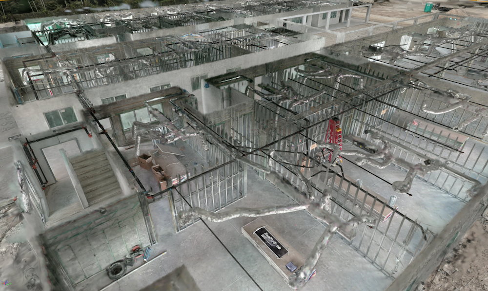
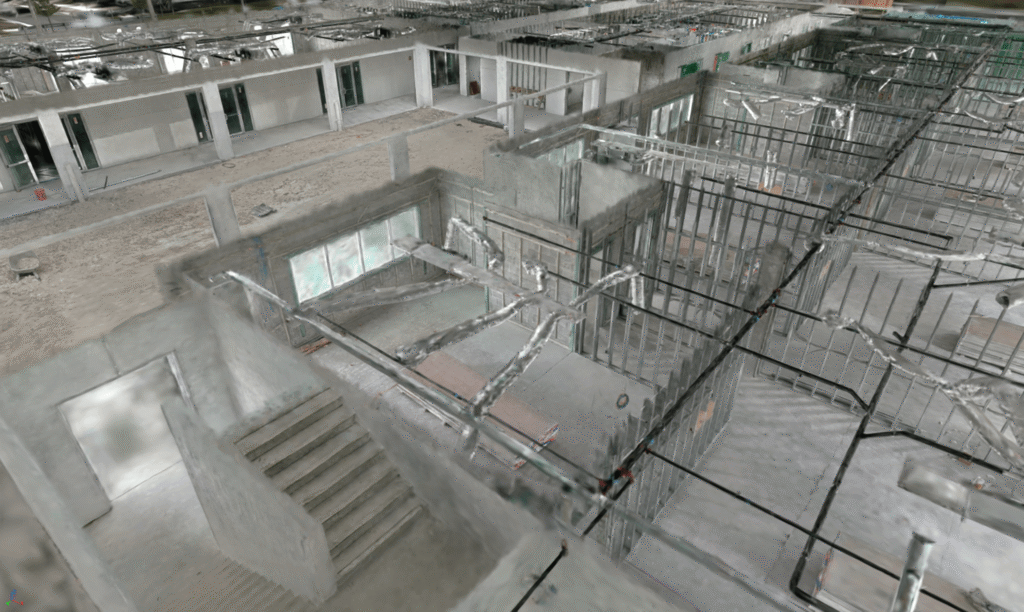
Architecture, Engineering, & Construction
For architects, engineers, contractors, and inspectors, RealitySync provides accurate as-built documentation that supports renovation planning, progress tracking, and site analysis.
Teams can review spaces remotely and collaborate with a shared visual understanding of the environment.
Insurance & Property Documentation
RealitySync helps insurance professionals capture detailed visual records of properties to support documentation, inspections, and claims evaluation.
Digital twins allow adjusters and stakeholders to review property conditions remotely, improving clarity and reducing the need for repeated site visits.
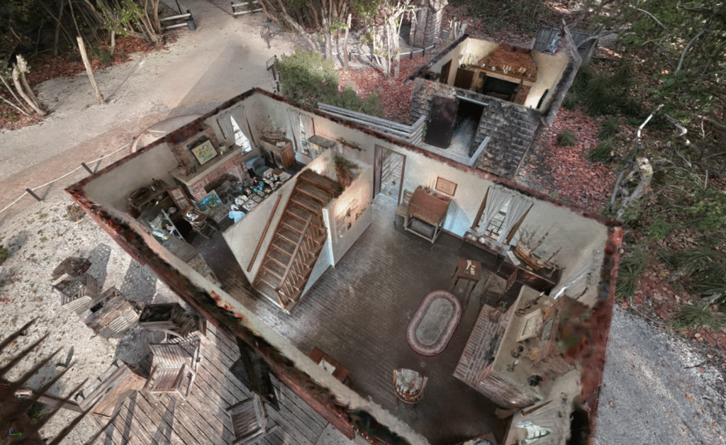
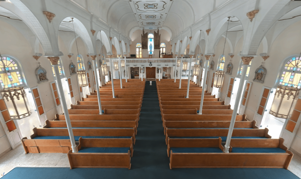
Cultural Heritage & Public Spaces
RealitySync helps organizations preserve and document historically or culturally significant spaces through detailed digital records.
These digital twins provide long-term documentation that supports restoration planning, archival preservation, and public engagement.
Public Safety & Preparedness
Emergency planning and response require accurate understanding of facilities and environments.
RealitySync provides detailed spatial models that help public safety teams analyze layouts, plan evacuation strategies, and improve preparedness for emergency scenarios.
See Your Space With Unparalleled Precision
Speak with a team member to learn how RealitySync can help you analyze your environment with clarity and confidence.